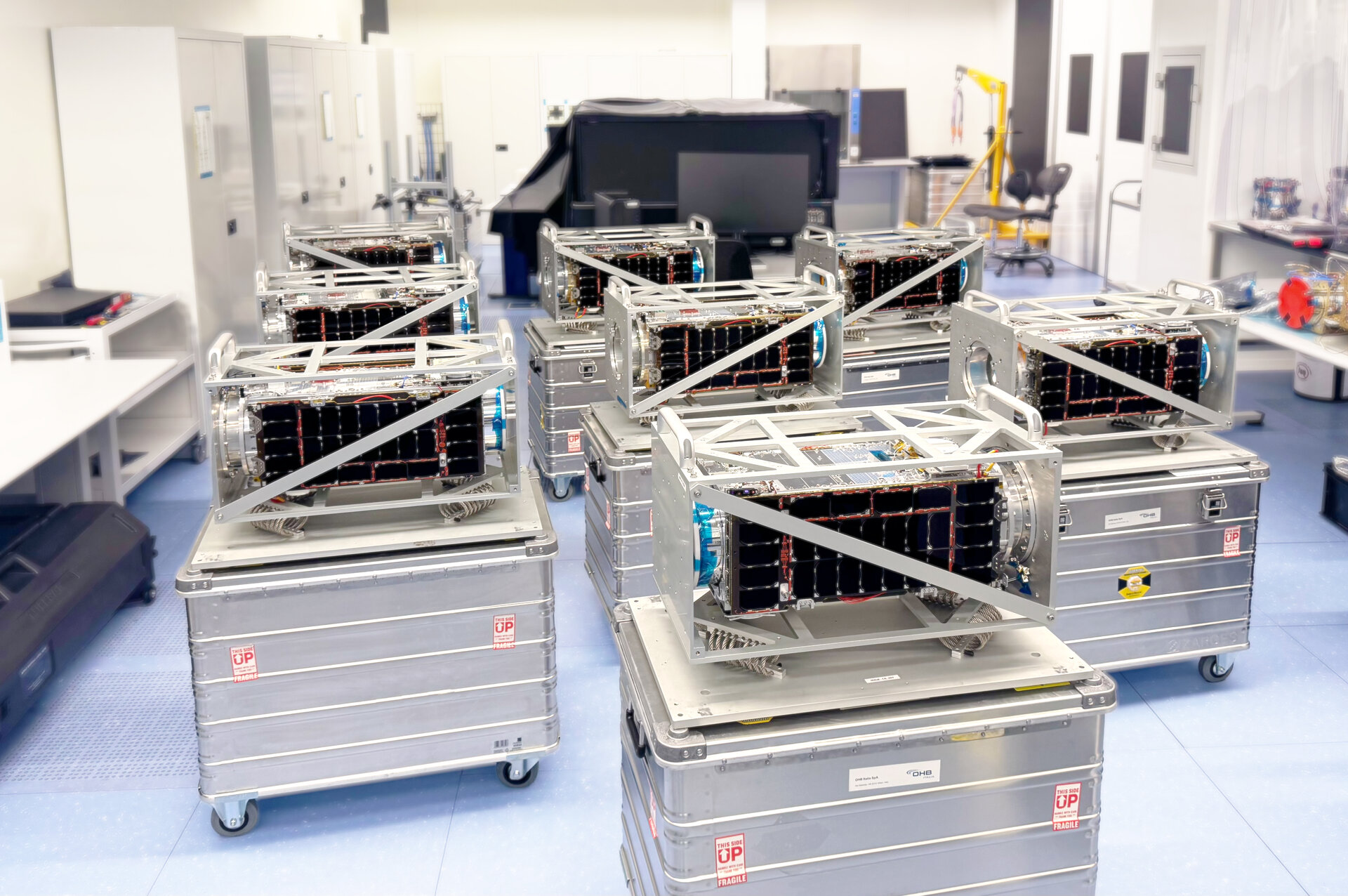
Mapsat has been awarded the European Space Agency tender for IRIDE PAL Services (Lot 2). This achievement confirms the company’s expertise in delivering innovative solutions for international space programs and marks another important milestone in its continued growth.
Author: admin
-

Mapsat CEO joins the ASAS Steering Committee
Mapsat is pleased to announce that its CEO has joined the ASAS Steering Committee. This appointment highlights the company’s growing role in the space industry and reinforces its commitment to supporting innovation and collaboration with key stakeholders. More information will be available soon.
-

News
From the latest updates to practical impact: through our News section, we keep businesses, institutions, and communities informed on trends, regulations, case studies, and technological developments shaping digital and ecological transformation. We select what matters, turn insights into actionable takeaways, and connect information to real opportunities—so you can convert knowledge into effective, measurable decisions for a more efficient, resilient, and responsible future.
-

Solutions
From the design of digital ecosystems and operational process optimization to the integration of artificial intelligence and cybersecurity systems: we apply cutting-edge engineering skills and platforms to create ready-to-use tools. We drive technological evolution across every sector through tailored answers, integrating hardware, software, and predictive analytics to enable the green transition, protect critical infrastructure, and improve people’s quality of life.
-

Strategic Partnership for Innovation: MAPSAT and International Leaders Soar into Space
The future of space exploration and Earth observation is being written through global cooperation. MAPSAT has officially announced a new strategic partnership with major international players in the aerospace sector. This alliance aims to combine expertise, resources, and cutting-edge technologies to push the current boundaries of innovation and develop next-generation space capabilities.
Joining Forces for New Milestones
The collaboration stems from the need to address the growing challenges of the Space Economy. By pooling MAPSAT’s know-how with the experience of global partners, the project will focus on developing advanced satellite systems, radar data analysis, and advanced solutions for planet monitoring.
Strategic and Technological Impact
The agreement represents not just commercial growth, but a genuine technological leap. The main benefits of this synergy include:
- Advanced orbital infrastructure: Designing more efficient flight segments.
- Proprietary algorithms: Ultra-fast data processing via artificial intelligence.
- Sustainability: Ultra-high precision global environmental monitoring.
Thanks to this synergy, MAPSAT consolidates its position as a benchmark in the aerospace landscape, proving that innovation requires a vision without borders.
-
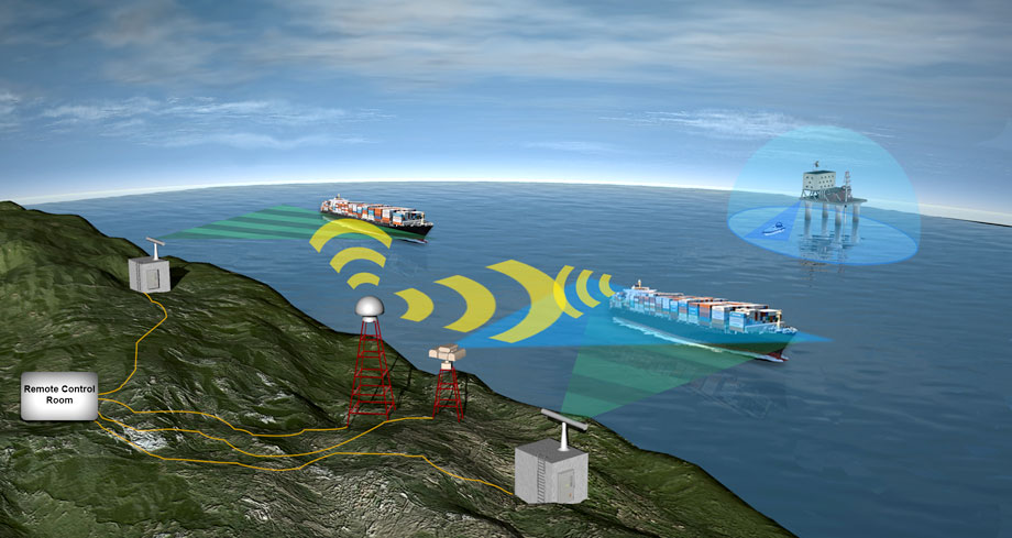
Maritime Security and Vessel Monitoring
Our oceans are increasingly crowded global highways. Managing maritime traffic and ensuring route safety is now a complex challenge. Traditional technologies alone are no longer enough to cover the vastness of the seas.
For this reason, the combination of Artificial Intelligence (AI) and satellite data is revolutionizing the vessel monitoring sector. This synergy allows for real-time vessel tracking, even in the most remote areas of the planet.
Satellites constantly capture imagery and AIS (Automatic Identification System) signals. Next, AI algorithms analyze this massive amount of data to identify anomalous behavior. For example, the system can detect sudden course changes or suspicious transponder shutdowns.
These advanced tools offer three main advantages:
- Collision prevention: Real-time calculation of high-risk trajectories.
- Combating illegal activities: Spotting illegal fishing and smuggling.
- Timely rescue: Immediate localization of vessels in distress.
The digitization of the seas is no longer a future option. It represents the current standard to protect crews, cargoes, and the marine ecosystem.
-
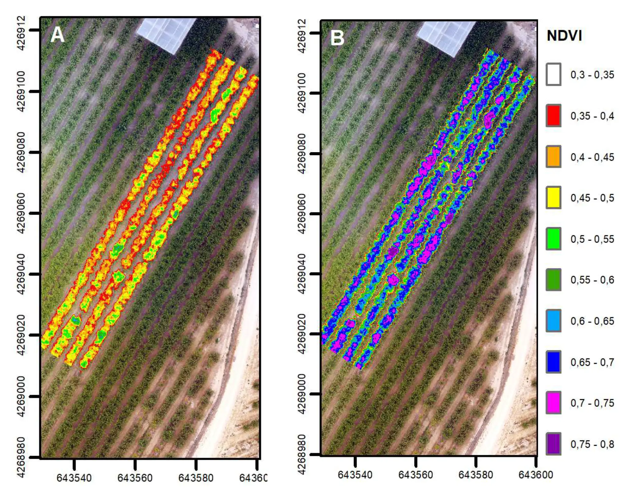
New Vegetation Health Index
Environmental health monitoring takes a decisive step forward. A new tool is about to revolutionize how we study the health status of our forests and agricultural crops. This is the new Vegetation Health Index (VHI), a high-resolution multispectral index recently presented to the scientific and technological community.
Until now, traditional satellite data offered a useful overview but was often limited by low spatial resolution. This made it difficult to identify early signs of water stress or the onset of diseases on individual plants or small plots of land. The new VHI overcomes these limitations by using advanced multispectral bands capable of capturing subtle variations in leaf reflectance.
The main benefits of this technology include:
- Millimetric precision: Identifies vegetation stress before it becomes visible to the naked eye.
- High resolution: Enables targeted monitoring specifically designed for precision agriculture.
- Resource management: Helps optimize irrigation and fertilizer use, reducing waste.
This index is poised to become the global standard for the fight against climate change and for future food security.
-
Early Warning & Risk Intelligence: Protecting the Future by Anticipating Risks
In today’s global landscape, emergency management can no longer be merely reactive. Preventing disasters requires a proactive approach based on the combination of Early Warning and Risk Intelligence. This synergy allows for the identification of imminent threats before they escalate into catastrophes, safeguarding human lives, infrastructure, and business continuity.
Understanding Natural and Anthropogenic Risks
Modern hazards are mainly divided into two categories:
- Natural risks: Floods, earthquakes, wildfires, and climate anomalies.
- Anthropogenic risks: Cyberattacks, industrial accidents, infrastructure failures, and geopolitical crises.
Monitoring these threats requires the continuous collection of massive volumes of data from IoT sensors, satellites, and global information channels.
The Role of Warning Systems and Operational Dashboards
However, raw data is not enough. To be useful, it must be transformed into actionable insights. This is where advanced technologies come into play:
- Early Warning Systems: Predictive algorithms analyze real-time data to send instant notifications at the first signs of anomaly.
- Operational Dashboards: Centralized graphical interfaces that clearly display risk maps, event evolution, and available field resources.
Thanks to these tools, policymakers and corporate managers can visualize scenarios in real time, coordinate relief efforts, and activate evacuation or business continuity plans with maximum precision. Investing in Risk Intelligence means shifting from damage control to mastering the future.
-

Coastal Monitoring and Water Quality
Coastal zone management represents one of the most complex environmental challenges of our time. The intersection of terrestrial and marine ecosystems makes these areas extremely vulnerable to pollution, erosion, and the effects of climate change. In this context, the shift from traditional monitoring, based exclusively on point sampling, to a satellite-based approach is revolutionizing Integrated Coastal Zone Management (ICZM).
The Role of Remote Sensing in Coastal Protection
Satellite remote sensing allows for the observation of vast geographic areas at a constant temporal frequency, overcoming the logistical limitations and high costs of in-situ analysis. By analyzing the reflectance of the water surface, satellites are able to identify chemical, physical, and biological properties that are crucial for determining the health of a basin.Sensors and Reference Constellations
Today, Europe has cutting-edge instruments at its disposal thanks to the Copernicus program. The Sentinel-2 (multispectral optical) and Sentinel-3 (ocean and land monitoring) satellites provide free, high-resolution data that allow for precise mapping of changes in water quality along coastlines.Key parameters monitored by satellite
Analysis of satellite data allows for the derivation of specific indices that act as a “thermometer” for the environmental quality of coastal waters.Chlorophyll-a and Phytoplankton Concentration
Monitoring chlorophyll is essential for identifying eutrophication, the excess of nutrients that leads to abnormal algal growth. This process can cause anoxia (lack of oxygen), endangering marine life and negatively impacting seaside tourism.Turbidity and Suspended Solids (TSS)
Measuring suspended sediment allows for monitoring coastal erosion processes and the impact of river discharges. High turbidity can limit sunlight penetration, damaging Posidonia oceanica meadows, which are essential for beach protection.Sea Surface Temperature (SST)
Temperature variations are critical indicators for studying currents and identifying thermal anomalies linked to industrial discharges or global warming, which can trigger migrations of alien species or mass die-offs.Detection of Hydrocarbons and Pollutants
Thanks to SAR (Synthetic Aperture Radar) sensors, it is possible to detect oil slicks or oil spills even in conditions of poor visibility or cloud cover, enabling rapid and targeted cleanup interventions.Towards Integrated Coastal Area Management
The effectiveness of satellite monitoring lies in its integration with other data collection tools. An integrated management strategy does not replace laboratory analyses, but enhances them through a multi-scale approach:Macro-scale (Satellites): Identification of critical areas (hotspots) and long-term trends over large areas.
Meso-scale (Drones): Detailed, ultra-high-resolution inspections of specific areas reported by satellite.
Micro-scale (Probes and Sampling): Validation of satellite data and precise chemical analyses at strategic points.
Advantages for administrations and management bodies
The adoption of these technologies offers tangible benefits:Cost reduction: Reduced need for boat trips for widespread sampling.
Prevention and Alerts: Possibility of creating early warning systems for toxic algal blooms.
Decision-making Support: Objective and historical data for planning coastal urban planning and marine protected areas.
In conclusion, integrating satellite solutions into coastal monitoring is no longer just a technological possibility, but a strategic necessity to ensure the sustainability of the Blue Economy and the conservation of marine biodiversity for future generations. -

Services
From strategic consulting and technology implementation to process optimization and data management: we offer integrated solutions to accelerate your digital and ecological transformation. We support businesses, institutions, and communities in achieving their sustainability goals, turning insights into concrete results for a more efficient, resilient, and responsible future.