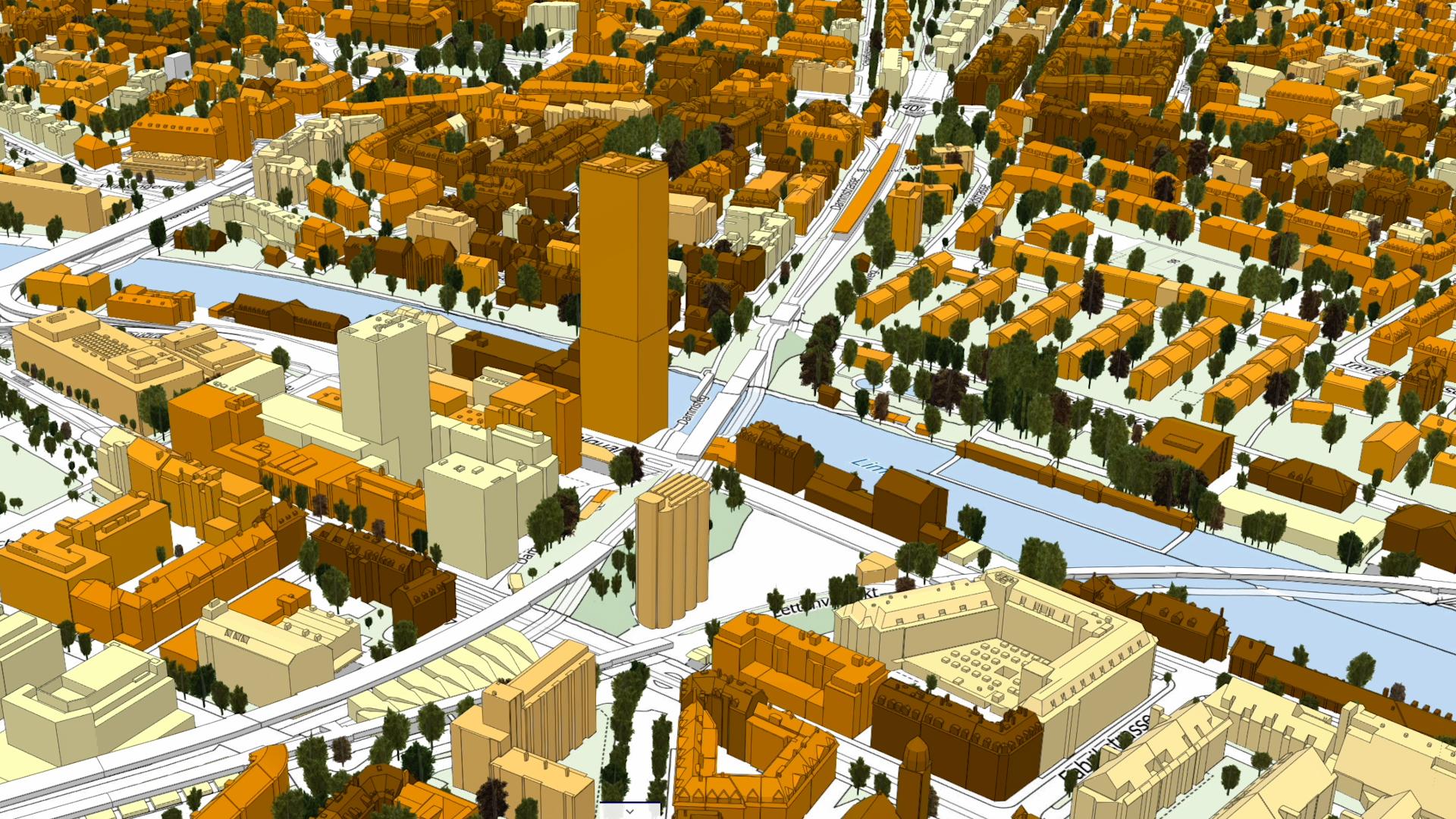
Territorial Digital Twin: The Future of Land and Urban Management
Imagine having an exact digital copy of an entire city, a watershed, or a whole region. Not just a simple 3D map, but a living model capable of updating in real-time and predicting what will happen tomorrow. This is the Territorial Digital Twin.
What is a Territorial Digital Twin?
A “digital twin” is a virtual replica of a physical area that integrates geometric, semantic, and dynamic data. Unlike traditional GIS (Geographic Information System) models, a Digital Twin does not simply describe where something is located, but simulates how that object interacts with its surrounding environment.
The core of this technology lies in the integration of three main pillars:
- 3D Modeling and BIM: For a millimeter-precise representation of buildings, infrastructure, and terrain morphology.
- IoT (Internet of Things): Sensors distributed across the territory that send real-time data on traffic, pollution, energy consumption, and water levels.
- Artificial Intelligence: To analyze Big Data and transform it into accurate forecasts and simulated scenarios.
Practical Applications: From Theory to Action
The true value of a Digital Twin lies in its ability to allow “zero-risk experimentation.”
1. Urban Planning and Architecture Before constructing a new neighborhood or a bridge, decision-makers can simulate the impact on natural lighting, ventilation flows, and vehicle traffic, optimizing the project before the first stone is even laid.
2. Environmental Risk Management During weather alerts, AI can simulate the progression of a flood or a landslide based on the exact topography of the land and real-time rainfall data, enabling precise evacuation plans and targeted mitigation interventions.
3. Predictive Infrastructure Maintenance By monitoring the health of bridges and roads via sensors, the digital model can signal potential structural failure before it becomes visible to the human eye, reducing both costs and risks.
The Benefits of a Data-Driven Approach
The adoption of territorial Digital Twins brings a paradigm shift to public administration and engineering:
- Data-Driven Decisions: Moving from intuition to scientific evidence.
- Sustainability: Optimization of energy resources and reduction of the urban carbon footprint.
- Resilience: An increased capacity to react and adapt to extreme weather events or emergencies.
The Territorial Digital Twin is no longer a futuristic vision, but an essential tool for anyone seeking to manage the complexity of modern territories efficiently, safely, and sustainably.
Leave a Reply